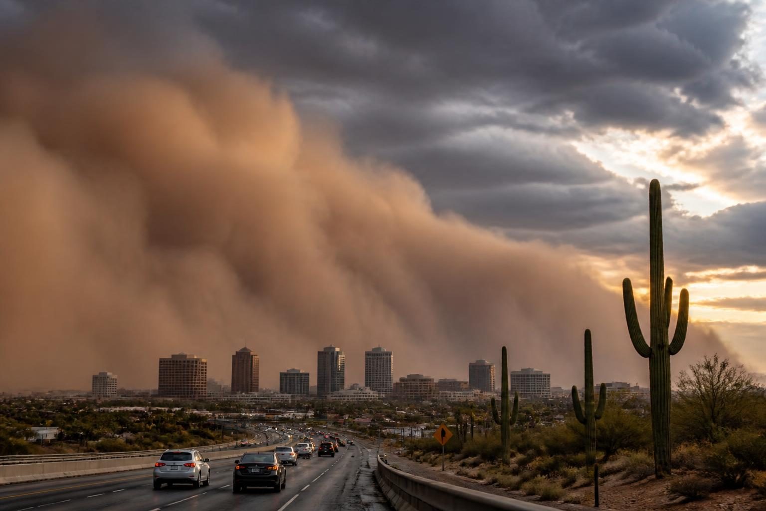
A dust storm warning issued near Phoenix on Wednesday night, Aug. 19, followed a line of strong monsoon storms that brought blowing dust, powerful winds, lightning and scattered outages across the Valley. The warning helped drive online interest in the phrase “dust storm warning,” but the alert described a fast-moving, localized hazard rather than a storm affecting all of the Phoenix area at once.
According to updates relayed by the National Weather Service’s Phoenix office, strong winds and blowing dust moved toward the southeast Valley at about 9:20 p.m. Mountain Standard Time. A dust storm warning was issued for southeastern portions of the metro area, including stretches of major highways near Phoenix and Mesa. Local television reports also described unsafe driving conditions, downed trees, debris and power outages.
The warning was temporary and tied to the Wednesday night event. People in Arizona should rely on current National Weather Service alerts and transportation updates for any later conditions on Thursday, Aug. 20, rather than treating the earlier warning as an ongoing alert.
Why “dust storm warning” is trending
The phrase began circulating as severe thunderstorms moved through the Phoenix metropolitan area on Aug. 19. ABC15 Arizona’s live updates reported that the National Weather Service issued a dust storm warning around 9:20 p.m. and said the warning covered portions of Interstate 10, Interstate 17 and U.S. 60 near Phoenix and Mesa.
Arizona’s Family reported that a wall of dust and strong winds entered the Valley around 9:30 p.m. after a severe thunderstorm warning had been issued. The same report said the National Weather Service issued blowing-dust advisories for areas including Buckeye and Avondale, South Mountain and Ahwatukee, and the southeast Valley near Queen Creek.
The event also had consequences beyond visibility. Reports from ABC15 and Arizona’s Family described outages affecting customers of Salt River Project and Arizona Public Service. The exact outage totals changed as crews responded, so figures reported during the storm should be understood as time-specific snapshots rather than a final count.
What a dust storm warning means
A dust storm warning is issued when dense blowing dust is occurring or is expected soon and visibility may fall to a quarter mile or less. That is substantially more dangerous than ordinary dusty conditions because drivers can lose sight of other vehicles, lane markings, signs and the road itself within seconds.
In the Phoenix region, dust storms frequently develop when thunderstorm outflow pushes across dry desert ground. Outflow is air that rushes outward from a thunderstorm. Those strong, spreading winds can lift loose soil and sand, creating a broad wall of dust that may move ahead of the rain.
This means a dust storm can affect a location that is not receiving heavy rain. A person may see a dark cloud or gust front approaching, followed by rapidly worsening visibility, while the heaviest thunderstorm activity remains nearby or behind the dust.
What was confirmed in the Phoenix event
- Timing: The main dust-storm threat developed Wednesday night, Aug. 19, 2026.
- Location: The National Weather Service identified southeastern portions of the Phoenix metro area as being affected by the warning, with major highway segments near Phoenix and Mesa included in local alert updates.
- Weather pattern: The dust was associated with strong monsoon thunderstorms and their outflow winds.
- Additional hazards: The storm system also produced high winds, lightning, heavy rain in some areas and possible hail.
- Local impacts: News reports described power outages, downed trees, debris and hazardous road conditions.
Not every part of the Valley experienced the same conditions. Weather alerts can be issued for specific sections of a metro area, and the boundaries may change quickly as the storm moves. Reports of dust in one community do not by themselves establish that the entire region is under a warning.
What drivers should do in a dust storm
The most important rule is simple: Do not drive into a dust storm. If a dust wall is visible ahead, slow down and look for a safe way to avoid it before visibility collapses.
If dense dust suddenly surrounds a vehicle, Arizona transportation officials use the “Pull Aside, Stay Alive” guidance:
- Pull completely off the roadway as soon as it is safe to do so.
- Turn off the vehicle’s lights, including emergency flashers if possible. Other drivers may follow the lights and collide with a stopped vehicle.
- Set the parking brake and keep your foot off the brake pedal.
- Remain inside the vehicle with the seat belt fastened until visibility improves and the storm has passed.
- Listen for updated instructions from the National Weather Service or local transportation agencies.
Drivers should not stop in a travel lane, on the shoulder beside fast-moving traffic when a safer location is available, or beneath trees, signs or other structures that could be damaged by strong wind. Conditions can change rapidly, so drivers should avoid relying on a single social-media post for the latest road status.
How dust storms differ from dust advisories
The National Weather Service uses different alert levels for blowing dust. A dust advisory generally signals that blowing dust is creating hazardous conditions, but the expected visibility and severity are lower than the threshold used for a warning. A dust storm warning indicates a more serious threat, including visibility that may drop to a quarter mile or less and conditions that can make travel extremely dangerous.
Alert names and boundaries vary by forecast office. The warning criteria used by the National Weather Service office serving Phoenix define a dust storm warning around dense blowing dust that reduces visibility to one-quarter mile or less and is occurring or imminent.
Why monsoon storms can create dust before rain
Arizona’s summer monsoon brings moisture into an otherwise very dry environment. Thunderstorms that form over higher terrain or outside the central Valley can generate strong downdrafts. When that air reaches the ground, it spreads outward as a gust front or outflow boundary.
Those winds can lift fine desert soil, construction dust and sand. The resulting dust wall may travel quickly and can arrive before the rain. In some cases, rain later wets the ground and temporarily reduces dust; in others, strong winds remain a threat even after the dust moves away.
The combination of extreme heat, thunderstorms and blowing dust creates several overlapping risks. Dust can make driving dangerous, while lightning, flash flooding, falling branches and downed power lines can create additional hazards nearby. A storm that produces little rain at one location may still cause damaging wind or visibility problems there.
What happens next
The Phoenix-area storm threat did not end all weather concerns after the dust warning expired. Local forecasts cited by Arizona’s Family called for another chance of nighttime storms on Thursday, Aug. 20, while extreme heat remained a major concern through the weekend. The precise timing and location of any later dust or thunderstorm activity remained uncertain.
Residents should check the current National Weather Service forecast for their location, monitor official emergency alerts and avoid unnecessary travel when dust or severe storms are approaching. People who encounter downed power lines should stay away and report them to the appropriate utility or emergency agency.
The key distinction is between the verified event and the continuing forecast: the Phoenix metro area did experience a dust storm warning and dangerous conditions on Wednesday night, but future warnings must be confirmed through current official alerts.