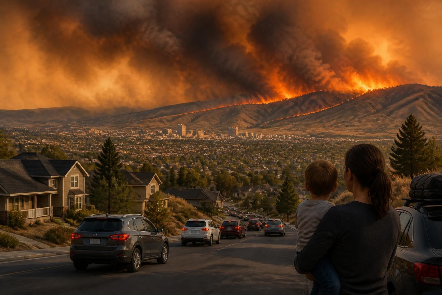
Nevada is trending because of the fast-moving Hawk Fire, which has burned more than 15,000 acres northwest of Reno and forced large-scale evacuations across the region. The fire began Saturday, August 22, 2026, near the Somersett area and expanded rapidly through dry grass, brush and timber.
As of the latest official incident update available Monday, August 24, firefighters had held established lines in some areas, but the fire remained active and conditions were still capable of changing quickly. Local officials continued to warn residents in evacuation zones to follow orders and monitor official maps rather than rely on older posts or informal reports.
The incident has drawn attention beyond northern Nevada because it combines several immediate concerns: homes have been destroyed, tens of thousands of people have been ordered or urged to leave, major roads have been closed, smoke has affected the Reno area, and emergency de-energization has caused power outages for some customers.
What is confirmed about the Hawk Fire
The Hawk Fire was reported on August 22, 2026, northwest of Reno, near the Somersett and Peavine Peak areas. The response is being managed through unified command involving the U.S. Forest Service, Truckee Meadows Fire Protection District and Reno Fire Department, with support from the Washoe County Sheriff’s Office and other agencies.
Washoe County’s August 24 update listed the fire at 15,051 acres. It said 720 personnel were assigned to the incident, supported by 14 crews, 95 engines, 10 helicopters and nine bulldozers. The same update listed the cause as human, although it did not provide a more specific explanation of how the fire started.
Fire officials said crews were working to keep the fire east of Dog Valley Road and south of U.S. Highway 395. On portions of the fire, firefighters used handlines and direct attack when conditions allowed. Aircraft and retardant were used to support lines near areas of heavy timber and around the Somersett side of the fire.
The latest official county update did not list a containment percentage. An Associated Press report published August 24 said firefighters had made progress and that the fire had not experienced new growth during an afternoon briefing, while also reporting that more than 30 homes had been destroyed. Damage assessments and evacuation boundaries can change as officials inspect affected areas.
Why the fire spread so quickly
Officials have described a combination of dry fuels, rugged terrain and breezy weather. The fire area includes tall grass, brush and timber, which can carry flames quickly when humidity is low and winds increase.
The National Weather Service office in Reno issued a red flag warning for parts of western Nevada and nearby northeastern California on August 22. A red flag warning means weather conditions are favorable for rapid fire growth, typically because of some combination of low humidity, dry vegetation and strong or shifting winds. It is not a prediction that a particular fire will necessarily grow, but it signals a higher-risk environment.
The August 24 incident update said hot, dry and breezy conditions were expected to continue supporting active fire behavior for roughly 48 hours. Officials warned that moderate- to high-intensity runs remained possible in dense fuels and that the fire could spread northeast or northwest depending on the interaction of wind, topography and vegetation.
Those factors help explain why a fire near open land can quickly become a community emergency. Reno and surrounding communities sit close to the wildland-urban interface, the zone where developed neighborhoods meet or intermingle with undeveloped vegetation. In those areas, evacuation routes, utility infrastructure and homes can be exposed at the same time.
Evacuations and shelters
Evacuation information has been one of the main reasons the Nevada trend has drawn broad public attention. On August 23, Washoe County officials said approximately 90,000 people were within “Go Now” or “Get Set” zones. The American Red Cross later said as many as 42,000 people had been forced to evacuate and that roughly 13,700 residences were in the evacuation area.
These figures describe different categories of people and should not be treated as interchangeable. A “Go Now” zone generally means residents should leave immediately. A “Get Set” zone generally means people should prepare to leave and may be directed out if conditions worsen. The boundaries and population estimates can change as officials update the map.
The Reno-Sparks Convention Center was being used as a major evacuation center, with the Red Cross helping provide cots and supplies. Washoe County also identified separate locations for small and large animals. Residents should check shelter availability before traveling because capacity, access points and operating status can change during an active emergency.
People who are under an evacuation order should leave as directed. Officials have repeatedly urged residents not to call 911 for general evacuation information, because emergency dispatch lines need to remain available for life-threatening emergencies.
Road closures and power disruptions
U.S. Highway 395 was closed in portions of the Reno area as the fire spread and crews worked near the transportation corridor. Other local roads, including sections of North Virginia Street and roads serving neighborhoods near Somersett, Golden Valley, Stead and Lemmon Valley, were also affected by closures or traffic controls.
Road conditions can change quickly because fire crews need clear access for engines, water tenders, bulldozers and emergency vehicles. Drivers should not enter closed areas to view the fire or retrieve property unless authorities have specifically authorized access.
NV Energy also reported emergency de-energization measures connected to the fire response. Emergency power shutoffs are intended to reduce the risk that electrical equipment will ignite or worsen a wildfire during dangerous conditions, but they can create significant hardship for residents, businesses and people who depend on electricity for medical equipment or refrigeration.
Residents should use the utility’s outage information and local emergency-management channels for restoration updates. They should not assume that a line is safe simply because power appears to be out.
Smoke and health considerations
Smoke from the Hawk Fire has affected communities and travel corridors in and around Reno. The county advised people who are sensitive to smoke to stay indoors when possible and monitor air-quality information.
Smoke can worsen symptoms for people with asthma, chronic lung disease or heart conditions, and it can also affect children, older adults and people who are pregnant. Practical steps include closing windows and doors when outdoor smoke is heavy, using indoor air filtration if available, limiting strenuous outdoor activity and following guidance from public-health officials.
An air-quality reading can vary substantially from one neighborhood to another, especially when winds shift or smoke settles overnight. Residents should use current local air-quality information rather than relying on a single earlier reading or a photograph of smoky conditions.
What happens next
Firefighters are expected to continue reinforcing containment lines, protecting homes and infrastructure, and monitoring areas where the fire could move through continuous fuels. Crews also must work around difficult terrain and a natural-gas line in the fire area, according to the county update.
The immediate priorities are protecting lives, preventing further structural loss and keeping evacuation routes open. After conditions improve, officials will need to inspect neighborhoods, assess damage, address utility hazards and determine when residents can safely return. An evacuation being lifted does not necessarily mean every property is safe to enter.
Residents returning after an evacuation should wait for official clearance, watch for downed power lines, damaged gas equipment, unstable trees, hot spots and weakened structures. They should document damage carefully for insurance purposes and follow local instructions for debris removal.
How to find reliable updates
- Check Washoe County’s Emergency Washoe website and official emergency alerts for evacuation orders, warnings and shelter information.
- Use the official Perimeter Map to check a specific address, road closure or evacuation zone.
- Follow updates from the Washoe County Sheriff’s Office, Reno Fire Department, Truckee Meadows Fire Protection District and the U.S. Forest Service.
- Check Nevada 511 before traveling, particularly in the Reno and northern Washoe County areas.
- Use AirNow or another official air-quality service for current smoke conditions.
- Call 911 only for emergencies, not for general information about evacuation boundaries or shelter capacity.
The Hawk Fire remains a developing emergency as of Tuesday, August 25, 2026. The most reliable picture is the latest update from incident commanders and local emergency officials; acreage, containment, road access, power service and evacuation boundaries may all change as crews continue the response.